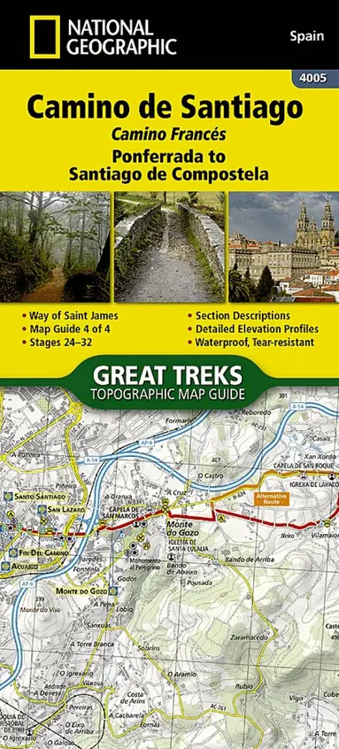
Camino de Santiago - Camino Frances Map 4 of 4
Bra pris nuLägsta priset på 1 månad
149 kr159 kr−6% senaste veckanhos Buyersclub · exkl. frakt
Jämfört med det lägsta pris vi sett de 30 dagarna före sänkningen.
64 kr skillnad mellan billigaste och dyraste butik i lager
Dubbelkollade priser
Jämför 3 butiker
- Buyersclub, 149 kr, frakt enligt butiken. Till butik (öppnas i ny flik)
I lagerKampanjFrakt: se butikenDubbelkollad 05:35
149 kr
Lägst
- Bokus, 213 kr, frakt enligt butiken. Till butik (öppnas i ny flik)
I lagerFrakt: se butikenDubbelkollad 07:51
213 kr
- Adlibris, 182 kr plus 35 kr frakt. Till butik (öppnas i ny flik)
Slut i lagerFrakt 35 krDubbelkollad 27 okt. 09:10
182 kr



Priser från butikernas flöden kan ha ändrats: det är priset hos butiken som gäller, så kontrollera det innan du handlar.
Prishistorik
Köp nu eller vänta?
Just nu kostar produkten 149 kr — det lägsta vi sett på 1 månad.
Under den tiden har det oftast legat runt 160–180 kr.
Pris idag
149 kr
- Lägst
- 149 kr
- Snitt
- 167 kr
- Högst
- 182 kr
| 2026-09-24 | 182 kr · Lägst hos Adlibris |
|---|---|
| 2026-10-08 | Ingen butik hade produkten i lager |
| 2026-10-09 | 159 kr · Lägst hos Buyersclub |
| 2026-10-14 | Ingen butik hade produkten i lager |
| 2026-10-15 | 159 kr · Lägst hos Buyersclub |
| 2026-10-28 | 149 kr · Lägst hos Buyersclub |
Om produkten
Camino de Santiago - Camino Frances Map 4 of 4
Läs merLäs mindre
Waterproof Tear-Resistant Topographic Map The Way of Saint James, known in Spanish as Camino de Santiago - or simply El Camino (The Way) - has been one of Europe's most iconic walking routes since 9th century pilgrims began making their way to the Cathedral of Santiago de Compostela to venerate the remains of Saint James. Though rooted in Christian tradition, the route has been reborn as a nondenominational spiritual rite and epic long distance trail that runs along Roman roads, across mountains, and through picturesque countryside and historic towns. The Ponferrada to Santiago de Compostela Topographic Map Guide booklet makes a perfect traveling companion when traversing the last section of the Camino Frances (French Route). This section of the trail includes the final 100km required to receive the famous Compostela pilgrim certificate when arriving in Santiago. This final booklet includes sections 24 - 32. A detailed description of each trail section is included that tells travelers about the many landmarks encountered along the way. Each Camino de Santiago Topographic Map Guide includes detailed topographic maps of 2 cm = 1 km. Each page is centered on the trail and overlaps with the adjacent pages so there is little chance of getting lost. Along the bottom of each page is a trail profile that shows the distance between towns, rest houses, and trail access points. The map and trail profile provide a step by step visual guide to hiking the trail. Every Great Treks map is printed on 'Backcountry Tough' waterproof, tear-resistant paper. A full Lat/Long grid is printed on the map to aid with GPS navigation. Every map purchase helps support the National Geographic Society, an impact driven, nonprofit organization with global reach that uses the power of science, exploration, education, and storytelling to illuminate and protect the wonder of our world. Map 4005