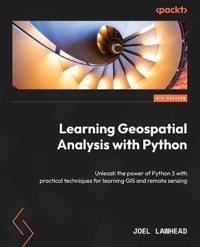
Learning Geospatial Analysis with Python
Dubbelkollade priser
Jämför 1 butik
- Adlibris, 422 kr, frakt enligt butiken. Till butik (öppnas i ny flik)
Slut i lagerFrakt: se butikenDubbelkollad 27 okt. 09:10
422 kr

Priser från butikernas flöden kan ha ändrats: det är priset hos butiken som gäller, så kontrollera det innan du handlar.
Prishistorik
Köp nu eller vänta?
- Lägst
- 422 kr
- Snitt
- 422 kr
- Högst
- 422 kr
| 2026-09-15 | 422 kr · Lägst hos Adlibris |
|---|---|
| 2026-10-06 | Ingen butik hade produkten i lager |
| 2026-10-08 | 422 kr · Lägst hos Adlibris |
| 2026-10-26 | Ingen butik hade produkten i lager |
Om produkten
Learning Geospatial Analysis with Python
Läs merLäs mindre
Harness the powerful Python programming language to navigate the realms of geographic information systems, remote sensing, topography, and more, while embracing a guiding framework for effective geospatial analysis Key Features Create GIS solutions using the new features introduced in Python 3.10 Explore a range of GIS tools and libraries, including PostGIS, QGIS, and PROJ Identify the tools and resources that best align with your specific needs Purchase of the print or Kindle book includes a free PDF eBook Book DescriptionGeospatial analysis is used in almost every domain you can think of, including defense, farming, and even medicine. In this special 10th anniversary edition, you'll embark on an exhilarating geospatial analysis adventure using Python. This fourth edition starts with the fundamental concepts, enhancing your expertise in geospatial analysis processes with the help of illustrations, basic formulas, and pseudocode for real-world applications. As you progress, you’ll