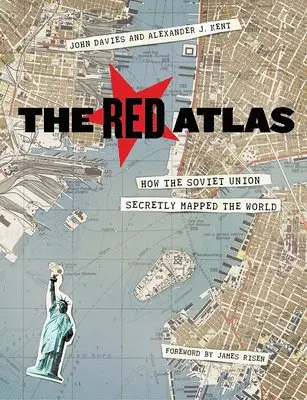
Red Atlas
- Vikt 0,77 kg
409 krhos Bokus · exkl. frakt
120 kr skillnad mellan billigaste och dyraste butik i lager
Dubbelkollade priser
Jämför 6 butiker
- Bokus, 409 kr, frakt enligt butiken. Till butik (öppnas i ny flik)
I lagerFrakt: se butikenDubbelkollad 26 okt. 23:51
409 kr
Lägst
- Akademibokhandeln, 529 kr, frakt enligt butiken. Till butik (öppnas i ny flik)
I lagerFrakt: se butikenDubbelkollad 26 okt. 23:53
529 kr
- Adlibris, 409 kr, frakt enligt butiken. Till butik (öppnas i ny flik)
Slut i lagerFrakt: se butikenDubbelkollad 00:10
409 kr
- Buyersclub, 419 kr, frakt enligt butiken. Till butik (öppnas i ny flik)
Slut i lagerFrakt: se butikenDubbelkollad 26 okt. 05:32
419 kr
- Storytel Books, 459 kr, frakt enligt butiken. Till butik (öppnas i ny flik)
Slut i lagerFrakt: se butikenDubbelkollad 26 okt. 21:00
459 kr
- Book Outlet.se, 683 kr, frakt enligt butiken. Till butik (öppnas i ny flik)
Slut i lagerFrakt: se butikenDubbelkollad 26 okt. 23:45
683 kr





Priser från butikernas flöden kan ha ändrats: det är priset hos butiken som gäller, så kontrollera det innan du handlar.
Prishistorik
Köp nu eller vänta?
Just nu kostar produkten 409 kr — 60 kr över det lägsta vi sett på 1 månad.
Under den tiden har det oftast legat runt 360–400 kr.
Pris idag
409 kr
- Lägst
- 349 kr
- Snitt
- 383 kr
- Högst
- 419 kr
| 2026-09-13 | 419 kr · Lägst hos Buyersclub |
|---|---|
| 2026-09-15 | 349 kr · Lägst hos Bokus |
| 2026-09-17 | 396 kr · Lägst hos Bokus |
| 2026-09-21 | 354 kr · Lägst hos Bokus |
| 2026-09-23 | 355 kr · Lägst hos Bokus |
| 2026-09-25 | 400 kr · Lägst hos Bokus |
| 2026-10-06 | 405 kr · Lägst hos Bokus |
| 2026-10-10 | 362 kr · Lägst hos Bokus |
| 2026-10-11 | 360 kr · Lägst hos Bokus |
| 2026-10-13 | 359 kr · Lägst hos Bokus |
| 2026-10-15 | 409 kr · Lägst hos Bokus |
| 2026-10-19 | 359 kr · Lägst hos Bokus |
| 2026-10-20 | 357 kr · Lägst hos Bokus |
| 2026-10-22 | 356 kr · Lägst hos Bokus |
Om produkten
Red Atlas
Läs merLäs mindre
Nearly thirty years after the end of the Cold War, its legacy and the accompanying Russian-American tension continues to loom large. Russia's access to detailed information on the United States and its allies may not seem so shocking in this day of data clouds and leaks, but long before we had satellite imagery of any neighborhood at a finger's reach, the amount the Soviet government knew about your family's city, street, and even your home would astonish you. Revealing how this was possible, The Red Atlas is the never-before-told story of the most comprehensive mapping endeavor in history and the surprising maps that resulted. From 1950 to 1990, the Soviet Army conducted a global topographic mapping program, creating large-scale maps for much of the world that included a diversity of detail that would have supported a full range of military planning. For big cities like New York, DC, and London to towns like Pontiac, MI and Galveston, TX, the Soviets gathered enough information to create street-level maps.What they chose to include on these maps can seem obvious like locations of factories and ports, or more surprising, such as building heights, road widths, and bridge capacities. Some of the detail suggests early satellite technology, while other specifics, like detailed depictions of depths and channels around rivers and harbors, could only have been gained by actual Soviet feet on the ground. The Red Atlas includes over 350 extracts from these incredible Cold War maps, exploring their provenance and cartographic techniques as well as what they can tell us about their makers and the Soviet initiatives that were going on all around us. A fantastic historical document of an era that sometimes seems less distant, The Red Atlas offers an uncanny view of the world through the eyes of Soviet strategists and spies.
Specifikationer
Fakta
- Vikt
- 0,77 kg
- GTIN
- 09780226389578
Uppgifter från tillverkare och butiker.